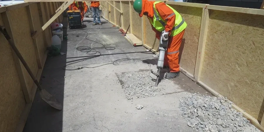
A total station and a laser level are usually the first tools we set up on a Repentigny site when a retaining wall is in the design phase. The reason is simple: the terrain here rarely tells the whole story from a simple visual inspection. The Lanaudière region, with Repentigny sitting on the north shore of the St. Lawrence River at roughly 45.73°N, presents a landscape shaped by ancient marine incursions. This means the surficial geology is dominated by sensitive clay deposits that can extend several meters deep before hitting competent till or bedrock. Before we sketch a single cross-section, we need to understand how these low-permeability silts will react to seasonal water fluctuations and lateral earth pressures. It is not just about holding back soil; it is about designing a structure that works with the natural drainage patterns of the Rivière l'Assomption watershed, which directly influences groundwater levels across much of the municipality.
A retaining wall on the north shore is only as reliable as its drainage system during the March thaw.